Advanced GIS Systems
The geographic information systems – GIS – are an integral part of the management, control and supervision processes in areas such as infrastructure management, agriculture, real estate, security, municipal information, planning, government ministries and many other areas.
We understand the various sectors in which this activity takes place, and know how to direct the characterization and establishment of the project so that it contains the exact needs of the organization itself, and not necessarily of a particular technology or method performed in other organizations.
We work with all existing GIS technologies, both commercial ones, such as Esri’s Arcgis products, and those of open source field, such as Qgis, GeoServer, PostGis and more.
Following this, we also perform integrations between different environments, if this matches the needs of the organization and the project.
Among other things, the company service includes the following sections:
- Define, Build & Maintain GIS Systems
- Use of Best Fit and Most Advanced Technologies
- Integration of All Data Sources
- Interfaces In front of Relevant Inner\Outer Systems
- Fit to Purpose Project
- Assimilation of Current and Future Local Regulation
- Simplicity and Accessibility
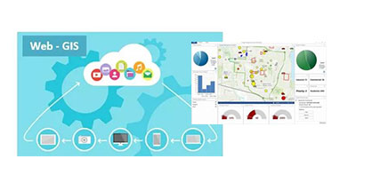
Web-GIS: Geographical Cloud
Depending on the needs, we set up GIS systems in the cloud (Portal Web GIS), which are located in the storage of the organization itself (On Premises configuration) or in a commercial based cloud (On Line Configuration). Such configurations contribute to the operational flexibility of the project and the entire organization, and enable the sharing of information and processes, for efficient and quality management.
- Establishment of On Line\On premises WEB-GIS Systems
- Accessible, Easy to Use user interface
- Multiple Devices Site Access
- Full Control Ability, Modifications Included
- Real Time Data Update
- Comprehensive Analysis & Visualization Ability
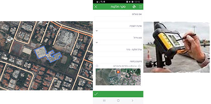
Data Collection & Field Survey
The collection of the required information is a critical step in establishing the enterprise GIS system. This phase begins before the system is set up and actually lasts throughout the life circle of the system, in order to maintain it up-to-date.
The collection of information is versatile and encompasses several steps such as locating the required information, performing preliminary actions to obtain / purchase the information, improving data, conducting field surveys on foot or by vehicle, scanning archives and office materials, aerial mapping and more.
There is great importance to the way in which the stages of information collecting is planned and to the methodology conducted for these stages. A correct and accurate methodology will save a lot of resources, since these processes often have a large and expensive work capacity, both in terms of the manpower required and in terms of the use of technologies and equipment.
At this point we will perform the following actions:
- Decoding and Solving Aerial Photos
- Analysis of 2D\3D Mode Mapping Data
- Different Sources Data Collection
- Spatial by foot\ by vehicle Data Completion Surveys
- Final Products Processing
- Compatibility With Relevant, International Formats and Standards
- Compatibility with Accepted Databases
Organization Consultancy
We accompany organizations in processes related to the characterization and management of GIS systems and geographic databases, including the execution of tenders, bills of quantities, selection of a particular technology or examination of a selected course of action.
One of the biggest challenges facing an organization that implements and maintains an organizational spatial information system, is the need to attach to the implementation of the system also a large-scale organizational process, since this action is an action that changes organizational norms. These are complex and sensitive processes that affect almost every professional supply in the life of the organization.
We have experience in these processes and accompany the organization from the initiation and characterization stages of such a system, and for the entire required operating period.
As part of this service we perform:
- Advice on solutions in the field of GIS in the organization
- Characterization of databases and architecture of GIS systems
- Writing tenders and technical specifications
- Integration with other relevant organizational systems – a combination of different systems to achieve maximum efficiency in the organization
- Smart data conversion between files and data from different sources to GIS environment
- Characterization and establishment of interfaces between systems
- Writing organizational processes to implement the integration
- Adaptation to existing and future regulation
- Accompanying and managing projects with contractors

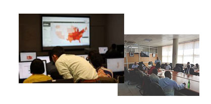
Training & Assimilation
Performing professional and effective training is a milestone in the implementation of GIS systems in the organization. As part of our conception, which sees the organization’s people as the real customers of the system, we strive to transfer the use of the system and information to the organization as quickly as possible. To this end, we offer a simple and effective training system, which combines the technical professional material with the natural organization environment and according to the type of users.
In our experience, it is better to deliver to each group of users the professional material that suits it. Thus, we deliver professional courses and tailored workshops for operators, information analysts, managers, etc.
Important to note: Tutorials can be performed through us even if the system implemented has been set up by another company! We know in depth all the systems used in most of the world and therefore adapt ourselves to any environment, even those that are already operational.
The success of the training chapter is the most significant for the success of the entire implementation phase, which contains other various technological and administrative elements.
We submit to the organization an orderly assimilation methodology and implement together with the members of the organization the required sections.
This chapter includes:
- GIS tools training – for all software, including Esri environment, QGIS and other
- Workshops for employees and managers
- Professional, Tailored-Made courses according to needs
- Implementation of GIS systems in the organization
- Accompanying work processes and training the organization’s staff in the office and in the field
- A maintenance period in the vision of “transferring the reins” to the organization itself
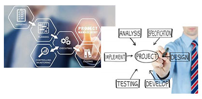
Management of GIS projects
Many organizations today are required to carry out GIS and mapping projects for a variety of purposes and operations. In quite a few cases, the organization does not have a real ability to manage such a project, usually due to a shortage of professionals in the organization. We have the experience and knowledge to manage projects in this field, including building the work plan, budget, execution and control.
As part of the management of the GIS project, we express the full experience gained for our people in over 20 years of activity. We conduct advanced processes in collaboration with the organization and in full transparency. At each stage of the project we update the organization through a fixed and detailed system of reports, in order to allow for changes and adjustments during the execution of the project.
Successful execution of the project is the overarching goal of any process in this area. We understand this and work with the best professional knowledge and experience we have acquired to ensure this result for each and every one of the company’s customers.
We perform:
- Preparation of work plans, procedures and guidelines
- Finding technological solutions and building processes
- Building the project budget
- Managing the execution of the project at all stages
- Process supervision and control (QC)
- Product Control (QA)
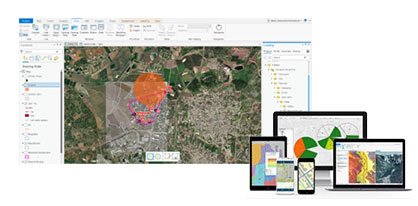
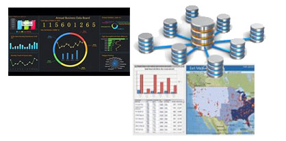
Spatial Data Analysis
In the analysis phase of the spatial information contained in the geographical system we actually express the tremendous power of a classical GIS system: the ability to produce operational conclusions based on spatial information analysis and its combination with analysis of alphanumeric information.
This capability of course requires early stages of operations, such as gathering and refining information, setting up an advanced system, implementing appropriate technologies, training staff and more.
From the moment the information begins to flow in the system, the main challenge becomes how to perform the correct analysis on it, the one that will lead to the most accurate operational conclusions, with a minimum of time and resources!
To do this, we use a variety of techniques, methods of operation and technologies, such as working with advanced databases, using first-class analytics tools (Analytics), writing code processes to perform operations, using complex models and more.
The basis for the ability to write appropriate processes is always the professional knowledge that exists in the company, and which guides us what and how to look for, in accordance with each type of project required.
We present the information obtained from the data analysis in the system in various configurations, such as information tables, control panels, maps, etc.
The information is available in accordance with the organization’s settings and accordingly there is also accessibility from any environment and from any device.
This service focuses on the following processes:
- Collection, arrangement and processing of existing information in the organization
- Convert data from various formats to GIS environment, such as conversion from DWG format to GIS format
- Establishment of databases according to needs – use of a number of advanced database products such as commercial and open source
- Full backup system, including emergency DR
- Use local / cloud platforms as needed
- Use of technology adapted to the organization
- Combining a cloud environment and a local environment
- Writing code for various processes and the ability to run and process
- Data analysis and display of real-time snapshot
- Running Analytics Methods
- Using Advanced Dashboard
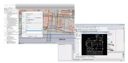
Data Conversion
Integrating spatial information systems (GIS) with the world of engineering design software (CAD) creates a number of challenges and difficulties, particularly with regard to file conversions between these two systems.
The most common practice is to convert a DWG CAD file, used in the engineering world by contractors, to a GIS file, used by the organization, usually as a GIS system for documentation and decision making.
Beyond the relatively simple geometric conversion, the main difficulty lies in converting the attribute data itself (Attributes), which cannot always be easily transferred from one format to another.
There are a number of problems in this context, including a lack of pre-determined templates (uniform standard), failure to define needs in the execution project, lack of professional knowledge and more.
Bottom line, file conversion between the two worlds, despite the technological advances of recent years, still remains a problem that requires a not-so-simple, and usually not inexpensive, deal, since it is essentially manual labor.
Since this point is central to the set of operations required in mapping operational infrastructures, we have established a file conversion system, designed for this purpose, which includes a working method that defines the entire process, with a technological process to perform such conversions quickly, accurately and cheaply.
Thus, we allow the company’s customers to embed in the GIS system large and significant amounts of important engineering data, which otherwise would probably have been pushed into some corner of the office and disappear from sight.
This process usually involves the following:
- Convert As-Made files to GIS environment
- Building an orderly methodology according to the type of data
- Use fixed templates to perform smart conversion
- Adaptation to accepted formats in regulation
- Export GIS files to other environments
- Save source data and conversion products in defined directories
- Characterization and writing of procedures for further data reception at the customer